Marine navigation is essential for safe and efficient voyages. Traditional methods like celestial and coastal navigation have evolved into modern technologies such as GPS, ECDIS, radar, AIS, and sonar. Integrated systems enhance accuracy, automation, and safety. However, challenges like GPS disruptions, cybersecurity risks, and weather conditions persist. The future of marine navigation is moving towards AI-driven automation and sustainability. Understanding these systems ensures better decision-making and secure maritime operations.
Nautical Charts and Paper Maps
Nautical charts and paper maps have been essential tools for marine navigation for centuries. They provide detailed information on coastlines, water depths, hazards, and navigation routes. Mariners use them for route planning, position fixing, and avoiding obstacles. Despite digital advancements, paper charts remain a reliable backup in case of electronic failures. Government agencies and hydrographic offices update charts to ensure accuracy. Combining traditional charts with modern GPS and Electronic Chart Display and Information Systems (ECDIS) enhances safe navigation.
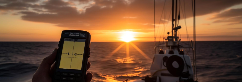
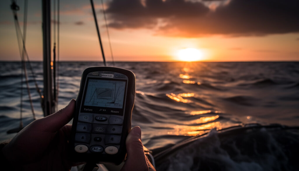
How GPS and Chart Plotters Revolutionized Marine Navigation
GPS technology has transformed marine navigation by offering precise positioning data. Chart plotters integrate GPS with electronic nautical charts, allowing for real-time route planning. They help sailors avoid obstacles and optimize fuel efficiency. Modern chart plotters offer advanced features like weather updates and AIS integration. Understanding these tools is crucial for both recreational and commercial mariners.
The Role of Radar and Sonar in Marine Navigation
Radar helps vessels detect obstacles, other ships, and landmasses in low visibility. Sonar is used to detect underwater objects, measure depth, and locate fish. Both systems play a critical role in collision avoidance and underwater exploration. Advanced radar systems can differentiate between moving and stationary objects. Sonar technology, especially multi-beam and side-scan sonar, enhances seabed mapping and navigation.
Choosing the Right Marine Navigation System for Your Boat
Selecting the right navigation system depends on the type of vessel and its intended use. GPS and chart plotters are essential for recreational boating. Commercial ships require advanced radar, AIS, and ECDIS for compliance and safety. Budget, ease of use, and integration with other systems should be considered. Investing in the right tools ensures a safer and more efficient journey at sea.
Future Trends in Marine Navigation
Marine navigation is evolving with artificial intelligence (AI) and automation, reducing human error. Autonomous ships are being developed, using AI-driven navigation for safer and more efficient voyages. Augmented Reality (AR) displays will enhance situational awareness by overlaying navigation data on real-world views. Eco-friendly navigation technologies are emerging to reduce fuel consumption and carbon emissions. Satellite-based navigation systems are improving accuracy, reducing dependency on traditional GPS. Cybersecurity advancements are critical to protecting navigation systems from hacking and spoofing threats. Machine learning algorithms will optimize route planning based on real-time weather and traffic data. Integrated navigation systems will combine multiple technologies for seamless marine operations. Blockchain technology may enhance data security and vessel tracking transparency. These innovations will make maritime navigation safer, smarter, and more sustainable in the future.
Modern Marine Navigation Systems
With technological advancements, navigation has become more precise, efficient, and automated. AIS is a tracking system used for collision avoidance. It allows ships to communicate their position, speed, and direction to other nearby vessels and coastal authorities. GPS is the backbone of modern marine navigation. It relies on a network of satellites to provide accurate real-time positioning and movement tracking. Chart plotters combine GPS data with electronic nautical charts (ENCs) to provide a visual representation of a vessel’s position. Radar (Radio Detection and Ranging) helps in detecting other vessels, landmasses, and obstacles, especially in low visibility conditions such as fog or nighttime.ECDIS is an advanced electronic navigation system that integrates GPS, radar, AIS, and sonar with digital nautical charts.
Safety and Regulations in Marine Navigation
Marine navigation safety is governed by international regulations to prevent accidents and ensure smooth operations at sea. The International Maritime Organization (IMO) establishes global maritime safety rules. The Safety of Life at Sea (SOLAS) Convention mandates essential navigation equipment like GPS, AIS, and ECDIS. COLREGs (Collision Regulations) define right-of-way rules to avoid vessel collisions. Port State Control (PSC) inspects ships for compliance with safety standards. Cybersecurity in navigation is becoming critical to prevent hacking and GPS spoofing threats. Adhering to these regulations enhances maritime security and environmental protection.
Global Positioning System (GPS)
The Global Positioning System (GPS) is a satellite-based navigation system that provides accurate location and time information worldwide. It operates through a network of at least 24 satellites orbiting the Earth. Ships rely on GPS for real-time positioning, route planning, and tracking. GPS enhances maritime safety by preventing collisions and ensuring precise navigation in all weather conditions. It integrates with Electronic Chart Display and Information Systems (ECDIS) for digital mapping. GPS also supports Automatic Identification Systems (AIS) for vessel tracking. Modern ships use dual-frequency GPS receivers for improved accuracy. GPS is resistant to environmental conditions, making it reliable at sea. However, GPS jamming and spoofing remain security concerns. Continuous advancements in GPS technology are improving accuracy, reliability, and cybersecurity.

Marine Insurance and Compliance
Marine insurance protects shipowners, cargo, and passengers from financial losses due to accidents, damages, or legal liabilities. Compliance with international maritime regulations like SOLAS and COLREGs is crucial for insurance coverage. Insurers require vessels to have proper safety equipment, certified crew, and regular inspections. Non-compliance can lead to policy voidance or denied claims. P&I (Protection and Indemnity) clubs provide liability coverage for shipowners. Adhering to safety standards ensures smooth operations, legal protection, and financial security in maritime activities.
Conclusion
Marine navigation has come a long way from traditional methods to highly sophisticated digital systems. Modern technology, including GPS, radar, sonar, and ECDIS, has revolutionized maritime travel, making it safer and more efficient. As technology continues to advance, marine navigation systems will become even more reliable and user-friendly, paving the way for autonomous vessels and smarter ocean travel. Understanding and utilizing the right navigation tools is essential for every mariner, ensuring safe and seamless voyages across the world’s oceans.